Pacific Crest Trail Section Hike: San Gorgonio Wilderness California
San Gorgonio is the highest point in Southern California at over 11,500 feet high. The Pacific Crest Trail (PCT) runs through the San Gorgonio Wilderness and in this article I share a 26 mile section hike of the trail that runs through this area. I am slowly section hiking the SoCal section (and then hopefully the rest) of the Pacific Crest Trail (PCT for short) that is 2,650 miles in total. In this series we are covering each section I hike and hopefully providing tips and insights into how you can spend an afternoon to a few days at a time on this trail that stretches from Mexico to Canada! Or for several months as a thru-hiker!

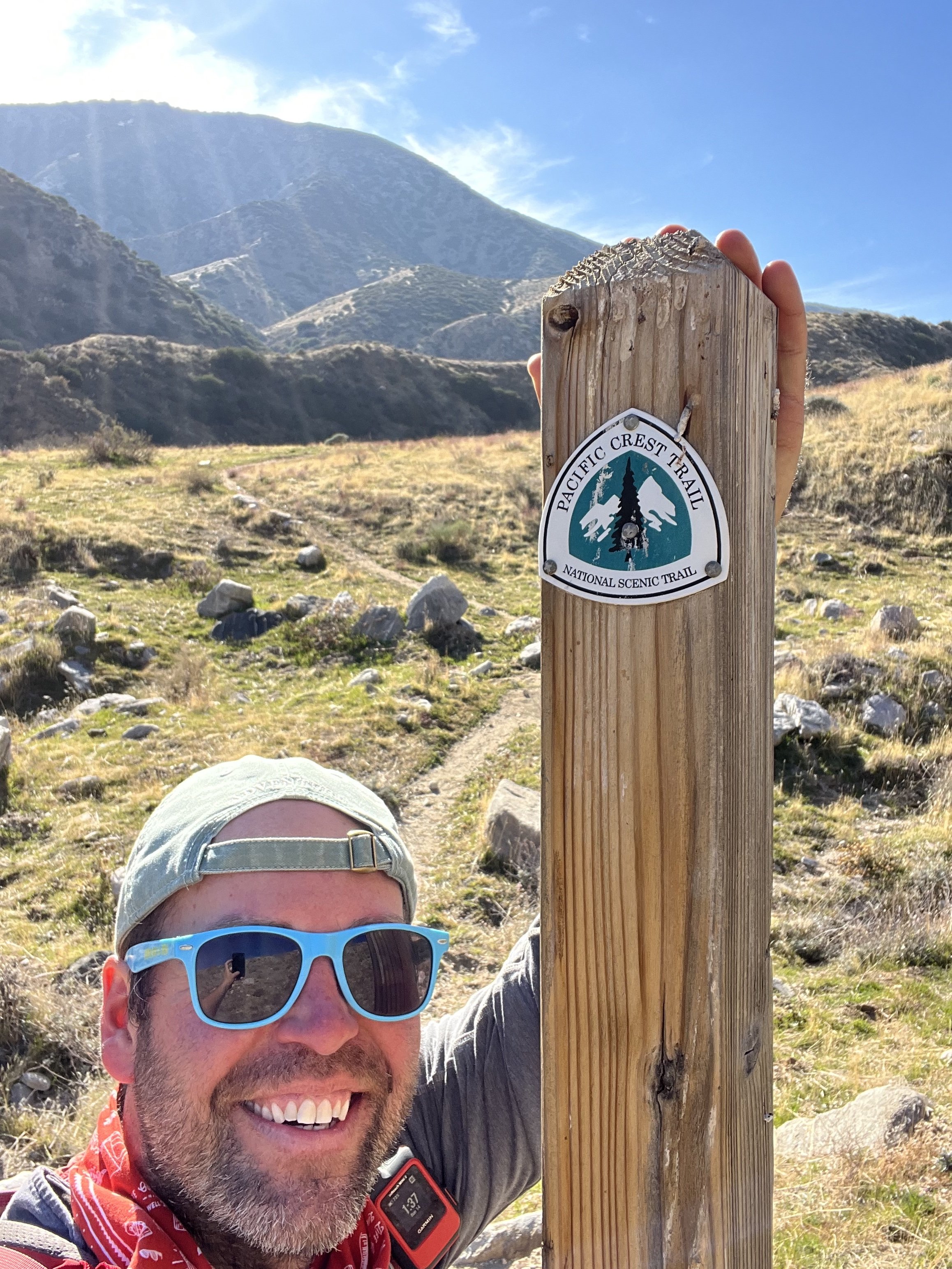
PCT Sign, Whitewater Preserve. California.
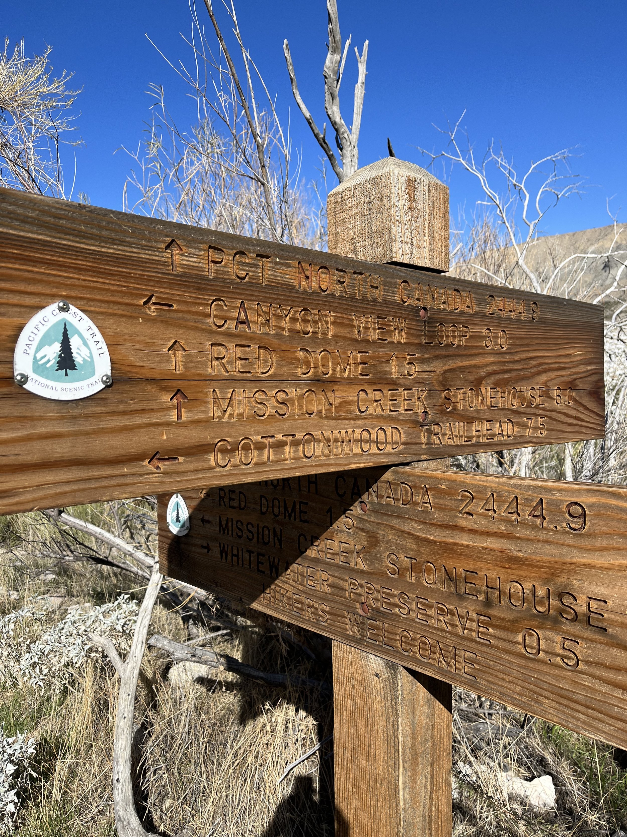
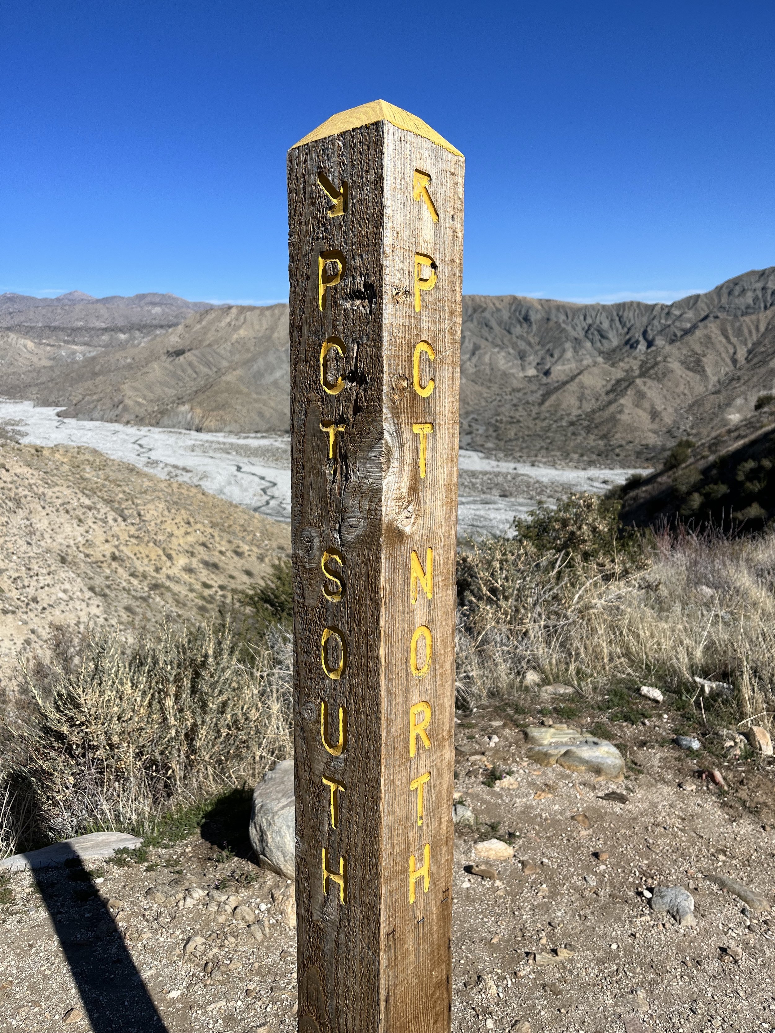
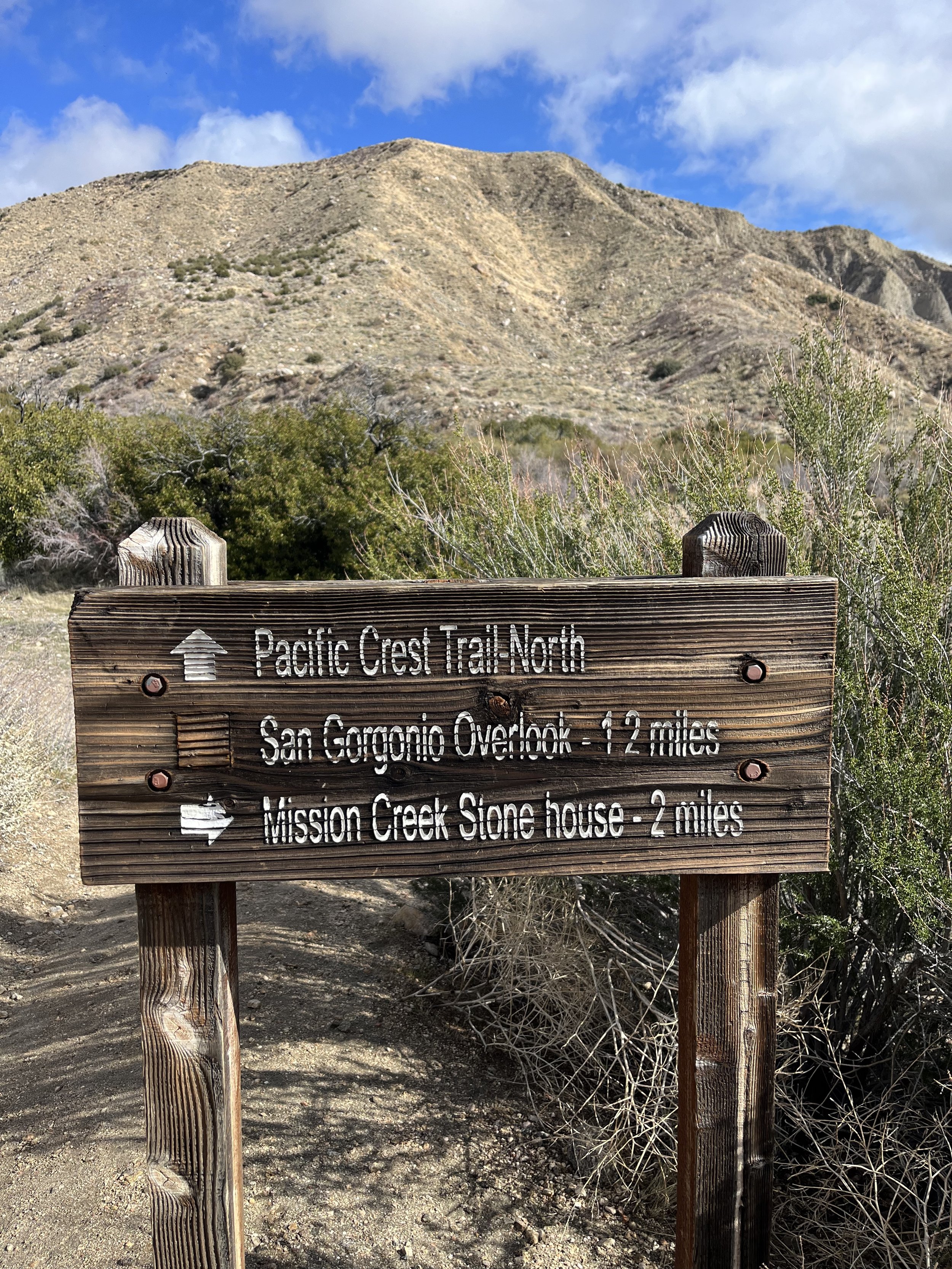
IF HEADING NOBO (NORTHBOUND) ON THE PACIFIC CREST TRAIL THE EDGE OF THE SAN Gorgonio Wilderness IS MILE MARKER 215.7 and extends to the side trail to the peak at mile marker 240. THIS 24.3 MILE STRETCH IS WHAT I COVERED IN Two DAYS AS OUT AND BACK DAY HIKES AND SOME OVERLAP MILES. There is an option to take the fish creek trail to the gorgonio summit. THERE IS PARKING, campsites, and water at whitewater preserve and mission creek preserve. The towns of Desert Hot Springs, Morongo Valley, Yucca Valley, Palm Springs, and Joshua Tree are all less than an hour away.


San Gorgonio Wilderness Pacific Crest Trail Section Hike Need to Know’s:
San Gorgonio is covered in snow in most of the year and to finish your section at the Fish Creek Trailhead we would recommend a 4WD Clearance Vehicle. If you continued on 10 more miles to the Onyx Summit there is a dirt road as well that hikers park at during the summer months to access the PCT. You could also head back to Whitewater or Mission Creek Preserve for more accessible vehicle drops/pickups.
The San Gorgonio summit add on is a SERIOUS hike and should be taken as such. Preparation and knowledge of the backcountry (along with a permit) is required. For more information on the permit, visit: https://sgwa.org/wilderness-permits/.
This section begins at the boundary of Sand to Snow National Monument. The Cahuilla Indians call the mountain Kwiria-Kaich, which means "bald" or "smooth," and consider it among the sacred peaks of southern California. From here you can get off trail at Whitewater Preserve, Mission Creek Preserve, hike back the way you came, or have a 4WD Clearance Vehicle.
Camping is available at Whitewater Preserve, at Mission Creek Preserve, and at the Mission Creek Trail Camp. More details can be found HERE. The Mission Creek Stone House requires a reservation to park/camp at the Stone House, you can make a reservation HERE.
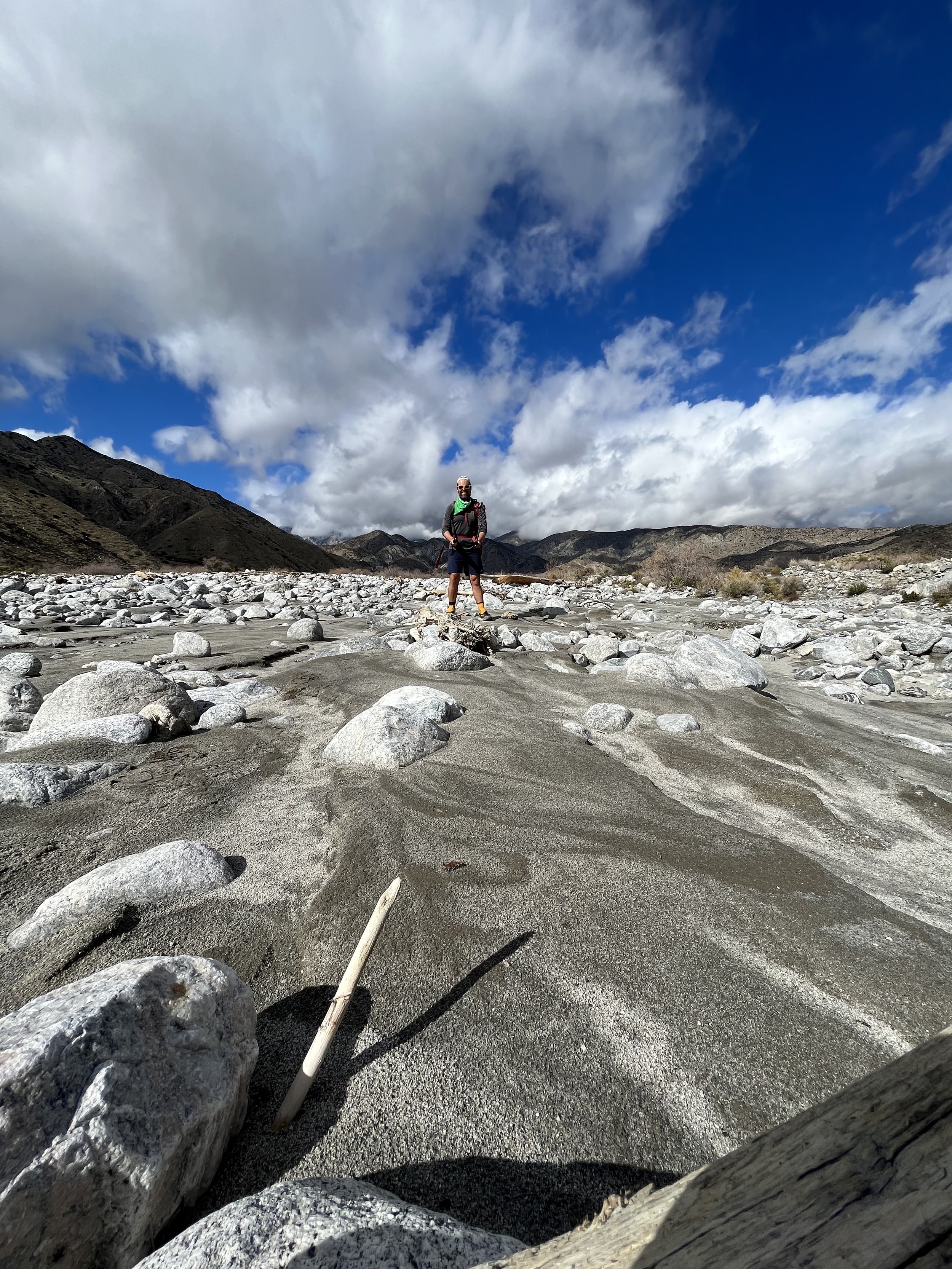
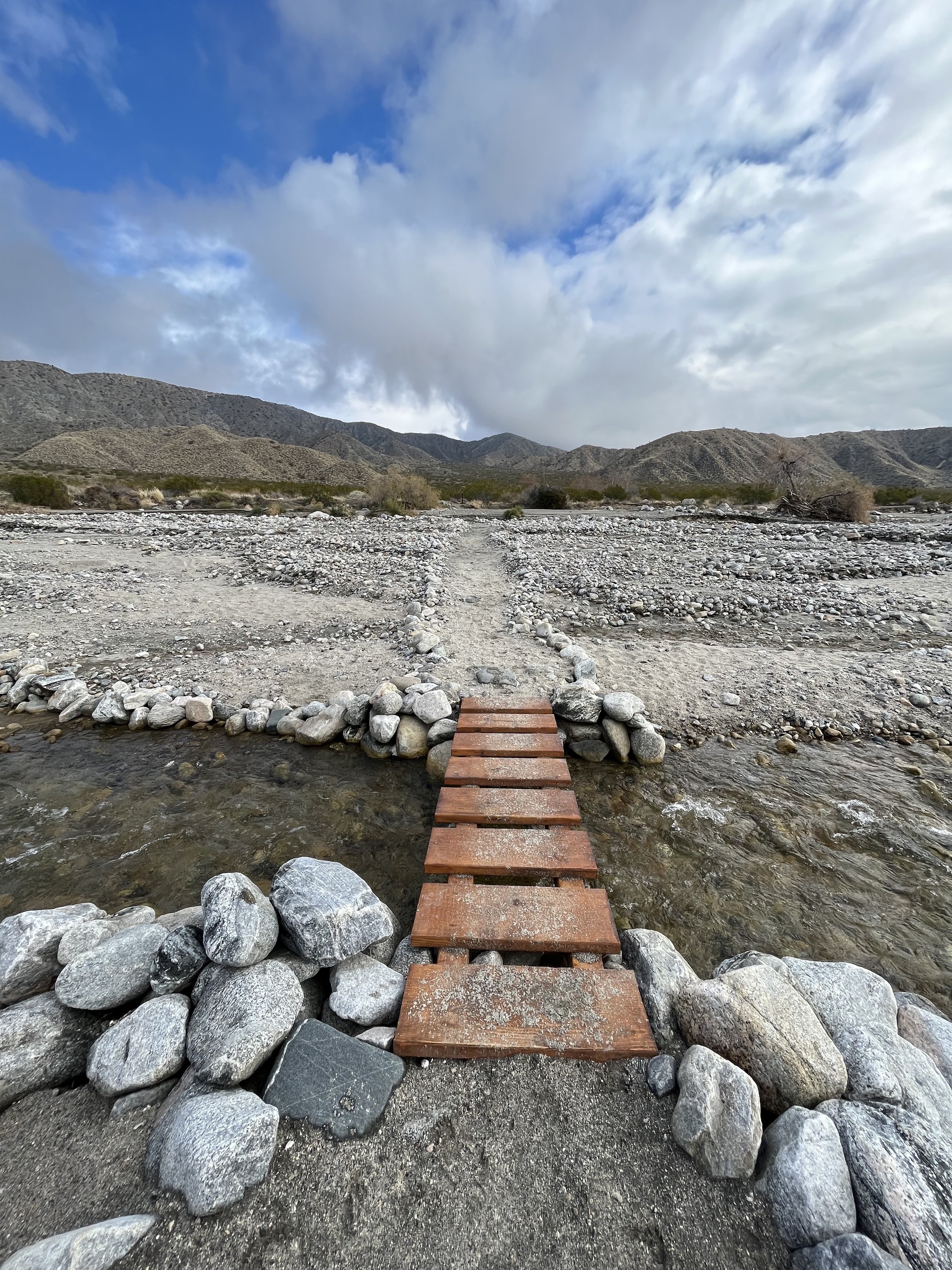
This section of the PCT will require a creek crossing of Whitewater about 2 miles past Whitewater Preserve. It is typically flowing year round and in January when I crossed it I had water up to my knees for several steps. It can be up to waist deep I have heard.
This section of the PCT will also require several crossings of Mission Creek as the trail winds NOBO. Depths of the crossings will vary.
There are also spots where you really need to pay attention as you cross the sand and the desert. The PCT poles and markings have been damaged by fire, hurricanes, and wind and markings are sparse. This requires, in my mind, extra focused concentration when not on an ascent or descent.
There are several unpaved roads where you could get off trail after mile marker 240 if heading NOBO. You could also consider continuing on to Onyx Summit and Big Bear with easier meetup locations. That section of the trail is covered in a different section hike article and video!
Whitewater Preserve on the PCT. Important section to follow the PCT posts!
What else happened that was memorable during this section hike?
The Whitewater Creek Crossing in January felt surreal. It was a warm winter but to get to do a safe creek crossing knee deep in the US in January was wild.
I left off at the “fence” on the one side of the Gorgonio Wilderness Boundary and I backtracked to the same fence coming SOBO on the PCT. I touched the fence both times, ate lunch by it once, but never actually opened it to enter/exit!
Met Boy Scout Troop 247 at the Mission Creek Stone House and they had gone out on the PCT the night prior. From Whitewater Preserve to the end of this section they were the closest I came to encountering another hiker on the PCT during this section.
If you are day hiking from Mission Creek and want to get on the PCT quicker getting their vehicle day pass access is fairly easy. Just make sure you reach out a few days in advance. It will cut 3.2 miles off of your round trip hike in and out for the day.
Walking between the San Jacinto and San Gorgonio Peaks as you glide across Sand to Snow National Monument on a clear day is some of the most gorgeous hiking I have ever experienced!
What is lacking in trail towns and resupplies in this section is made up for with the great services offered by the Wildlands Conservancy’s that the PCT crosses!
WHAT GEAR DO I USE AND LIKE THE MOST ON MY PCT SECTION HIKES?
Hoka One Kaha’s are my trusted shoes.
I use my REI 40 Liter Backpack.
Darn Tough Vermont and Merino Wool Socks from REI and SmartWool are my go to’s.
Osprey Water Bladder and Lifestraw Collapsible Filter for hydration.
I wear New Balance running shorts mainly and much prefer that to more typical hiking shorts.
The PCTA and PCT Water Reports in addition to the Half Mile Maps and Trail Notes are outstanding resources (and could save your life…!)
I carry a Garmin GPS and if I were to thru hiker use the Farout (used to be Guthook) App as well.
This section really showcases two of the biggest peaks of SoCal and the massive wilderness areas protected in and around them. If you are fortunate you will have beautiful views of San Jacinto and/or San Gorgonio every day on this section.
The Wildlands Preserves are really the only connection point outside of the wilderness on this stretch. There’s little cell phone signals, very few non thru hikers, and many creek crossings.
To be this close to Palm Springs, Desert Hot Springs, Joshua Tree, and yet also be this entrenched in the wilderness is super special. Most don’t have days to just get to the wilderness to access it. This is what I love about this section. Its proximity to provide great access to the “woods” yet also not have to take as much time getting there as the time you actually have there.
The other fun and interesting portion of this section actually is the opposite of the high peaks. It’s the “desert floor”. You have big massive waterways that run year round in the driest area of the country. And you get to move across them many times. This contrast of “sand to snow” is what gives the monument area its name and really highlights the beauty and differences of that beauty in the state of California.
Stunning. Wild. Wet. Memorable. That’s how I would sum up this section of the Pacific Crest Trail!

This is a great portion of the SoCal PCT Desert Section.
As I mentioned it is super close to anyone living in Indio, the “Other Desert Cities”, and not far for LA and San Diego residents. It features the top of Southern California, two magnificent preserves protected by the Wildlands Conservancy, and the Sand to Snow National Monument.
This 24.5 mile stretch was done in two fast moving several hour day hikes with some out and back miles on top of it. You can also tack on (always check the weather first) a summit of San Gorgonio via the Fish Creek Trail to add another day to this section. You can also continue on to Big Bear or back the way you came!
Have fun, prepare, and welcome to creek crossings, high peaks, and sandy stretches!
Thanks for reading and happy trails to you! Whether you are planning a thru, section, or day hike…or are a trail town local, trail angel, or just someone wanting to learn more about the Pacific Crest Trail…I hope the PCT gives you what you need! Don’t forget to Leave No Trace and pack your 10 Essentials!
Comment below with questions or your experience on hiking the PCT in the SoCal or specifically the San Gorgonio Wilderness Section.
Because Adventure Feeds the Soul,
Mike R

Looking down on the descent towards Mission Creek while heading NOBO on the PCT.