Pacific Crest Trail Section Hike: San Jacinto and SoCal Desert
Lying between the San Jacinto and San Gorgonio peaks is a desert stretch of the PCT in Southern California. This section takes you downhill for 26 miles, underneath the Interstate, through a Windmill Farm, and finally to the boundary of a National Monument that hosts the highest point in Southern California. I am slowly section hiking the SoCal section (and then hopefully more) of the Pacific Crest Trail (PCT for short) that is 2,650 miles in total. In this series we are covering each section I hike and hopefully provides tips and insights into how you can spend an afternoon to a few days at a time on this trail that stretches from Mexico to Canada!

One of the more famous possible sleeping spots on the PCT is underneath Interstate 10 near Palm Springs!
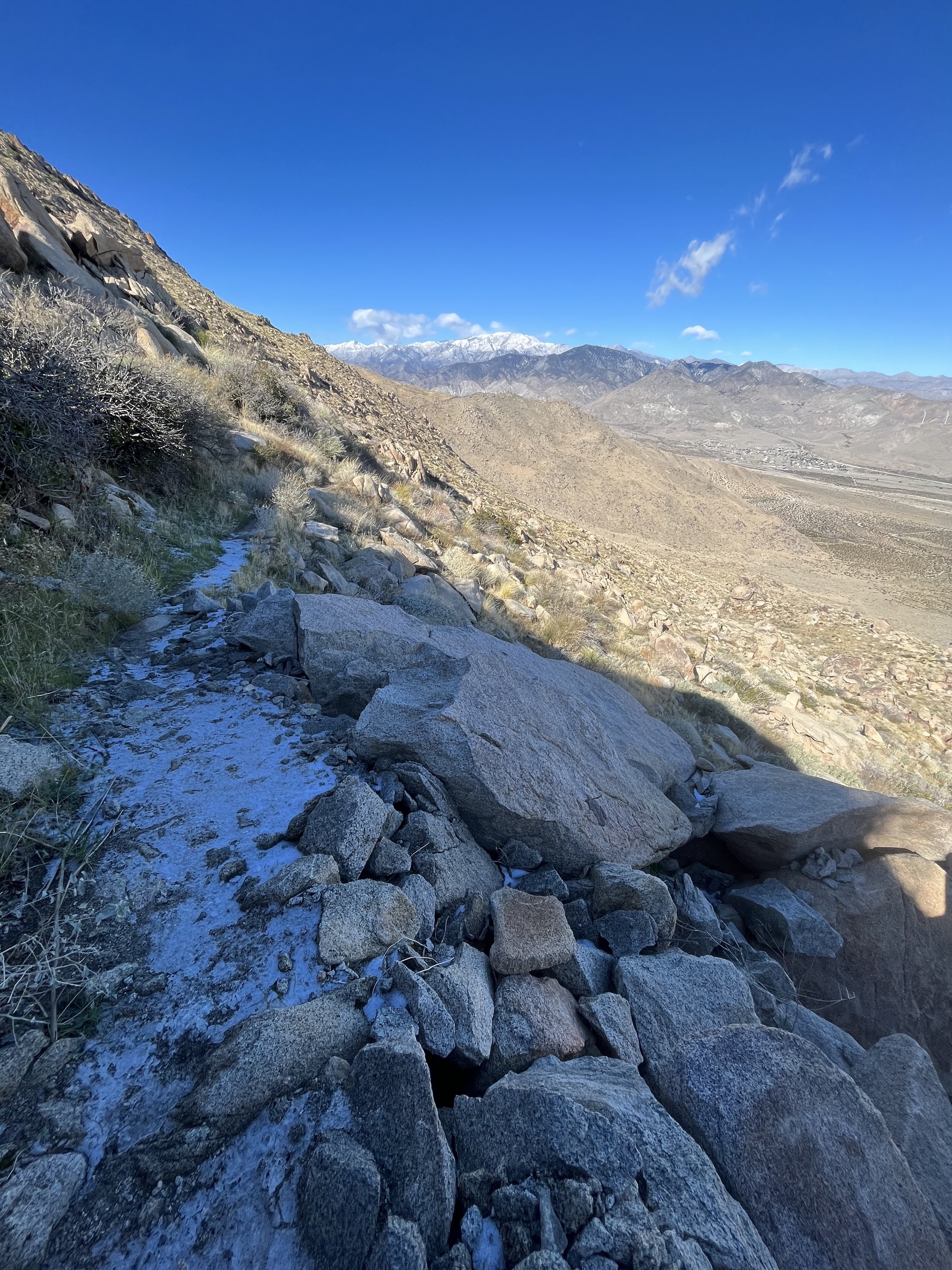
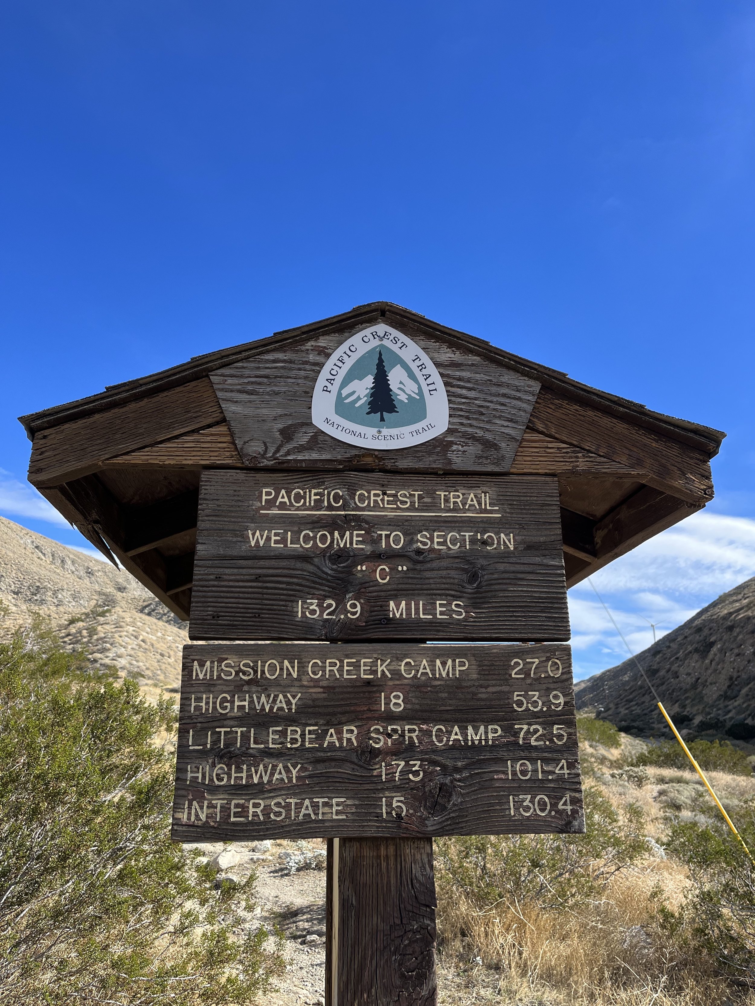
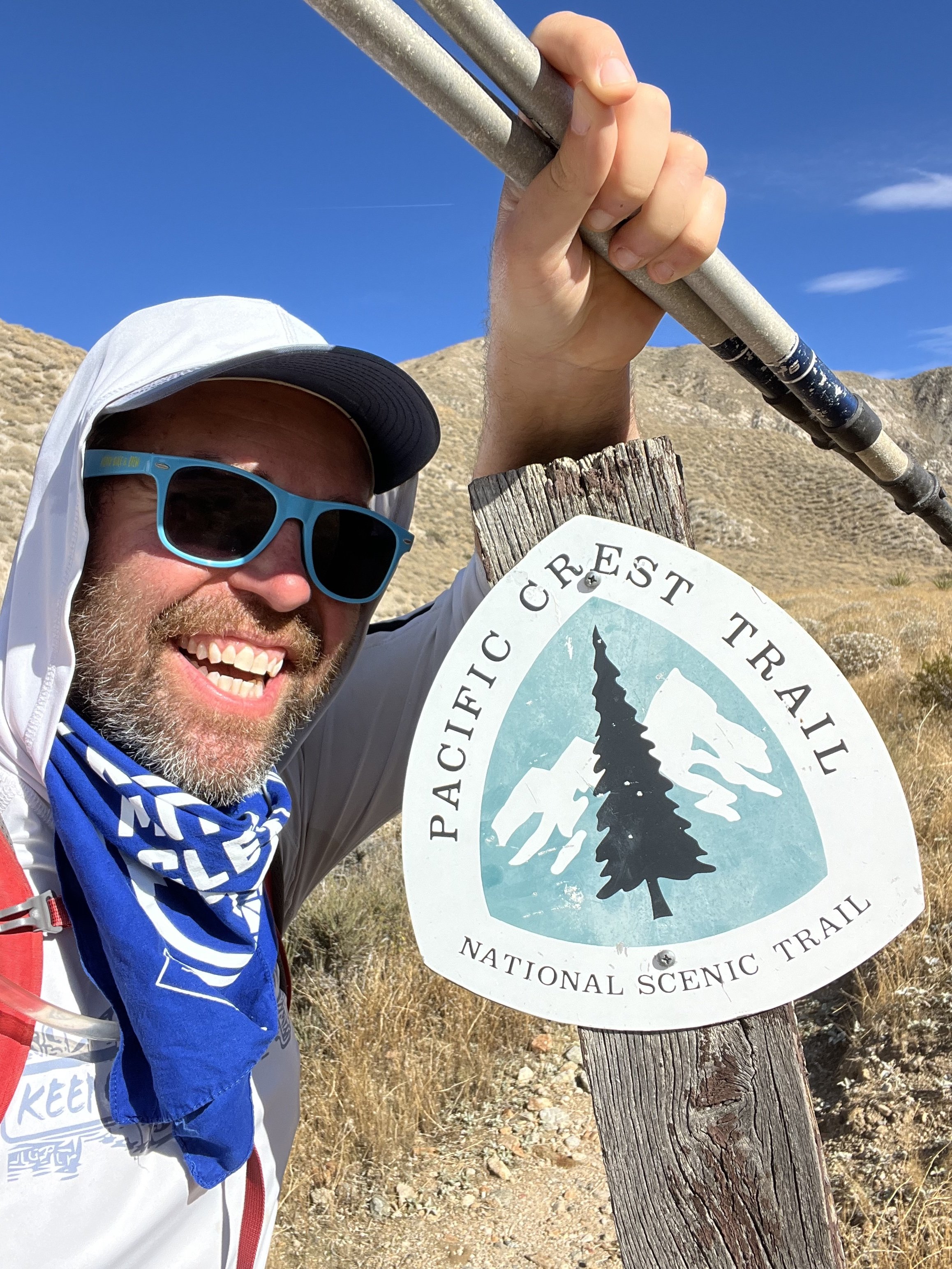
IF HEADING NOBO (NORTHBOUND) ON THE Pacific Crest Trail Idyllwild CA IS LOCATED AT MILE MARKER 179.4 ON THE 2023 PCT AND THE edge of the sand to snow national monument is mile marker 215.7. THIS 36.3 MILE STRETCH IS WHAT I covered in three days as out and back day hikes and some overlap miles. There is resupply, parking, and/or water in idyllwild, at snow creek canyon, and in cabazon.


Snow Creek and Cabazon Pacific Crest Trail Section Hike Need to Know’s:
This section of trail becomes a dangerous winter hike after the first big snow falls up in the San Jacinto Wilderness. Some years are worse than others and summer will be HOT and have a stretch filled with rattlesnake potential. I would recommend a spring/fall trek if possible.
Idylwilld California is a great resupply town that doesn’t have a human mayor! Mayor Max handles all the duties in between fetch, naps, and bones I believe :).
Snowcreek Canyon has some off street parking and a water spigot that you should filter before heading into the I-10 desert stretch. This is lovely year round desert hiking that you could do without the high peak stretch in Jacinto if there is snow on the mountain.
There is also parking on Tamarack Road just beyond the I-10 crossing. I left my car on the street twice for day hikes and it’s right next to the trail crossing on the street. There are a lot of different great resources out there that I will list the exact GPS Coordinates land you right where the PCT crosses Tamarack Road, I found this thanks to Halfmile and their PCT Maps.
This section ends at the boundary of Sand to Snow National Monument. The Cahuilla Indians call the mountain Kwiria-Kaich, which means "bald" or "smooth," and consider it among the sacred peaks of southern California. From here you would either return to your car at Cabazon or Snow Creek or head towards Whitewater Preserve (that is covered in a different section hike guide of mine!)
You are only 15 minutes from Palm Springs if you are in the mood for a little R&R before or after your hike! You are also close to Joshua Tree National Park and many other epic desert activities in the Coachella Valley so you could easily tack on a few more days doing other desert vibey adventures in the region.
You can sleep under the bridge at I-10 but I feel that would be super uncomfortable even with ear plugs. The campsites at Whitewater Preserve are supposed to be very nice, just food for thought. This section for me was completed as a series of day hikes!
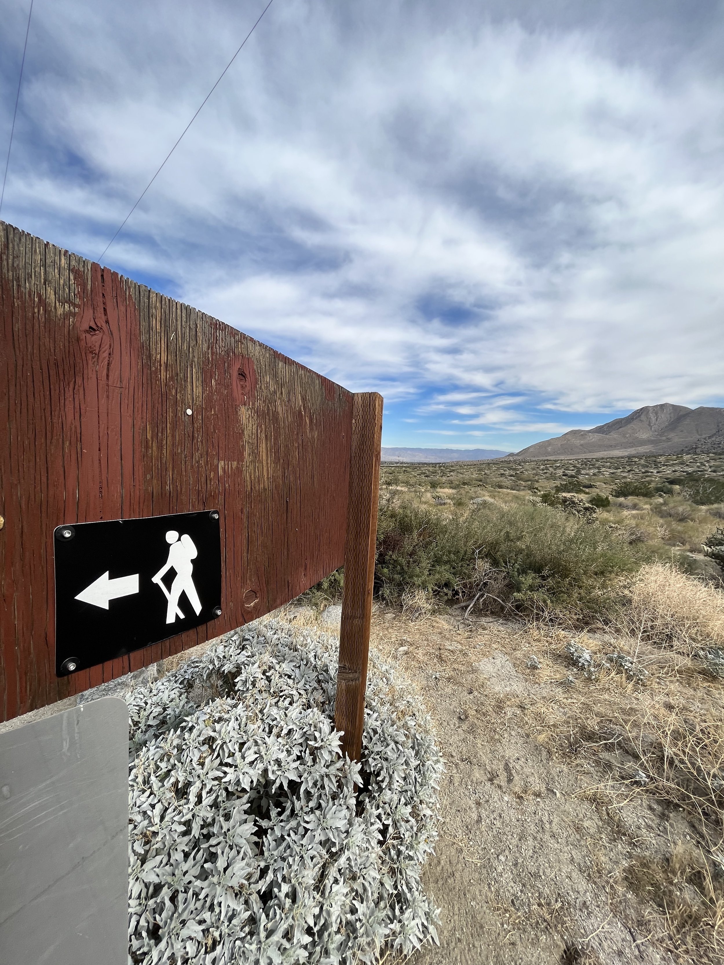
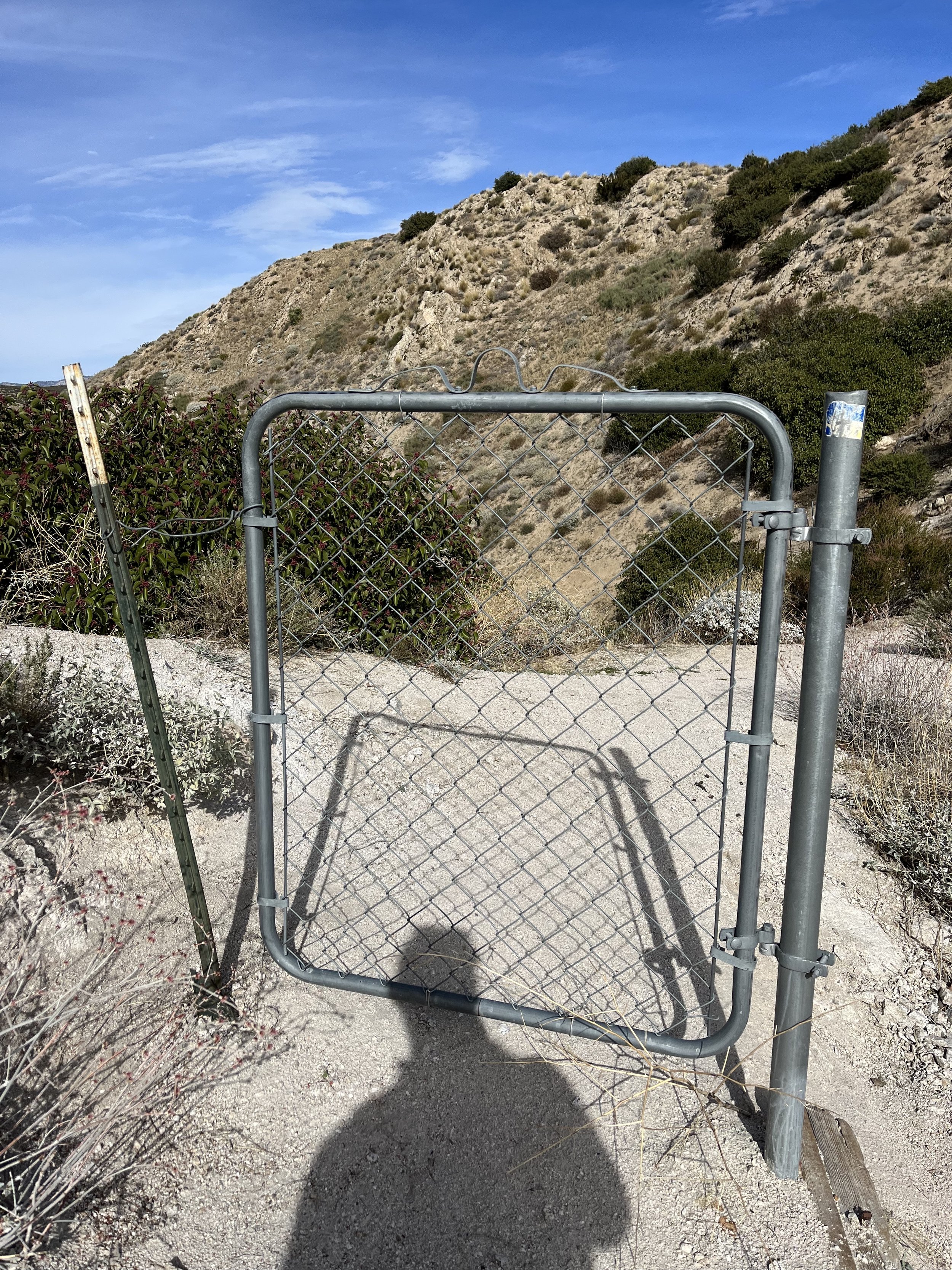
The PCT provides yellow painted posts in the desert section, arrows when turning, and then mainly just following the trail up and down when ascents/descents are involved. The blazes are relatively well marked in the flat desert section but spaced far enough apart that you should PAY ATTENTION and be on the lookout for the next one as you go.

What else happened that was memorable during this section hike?
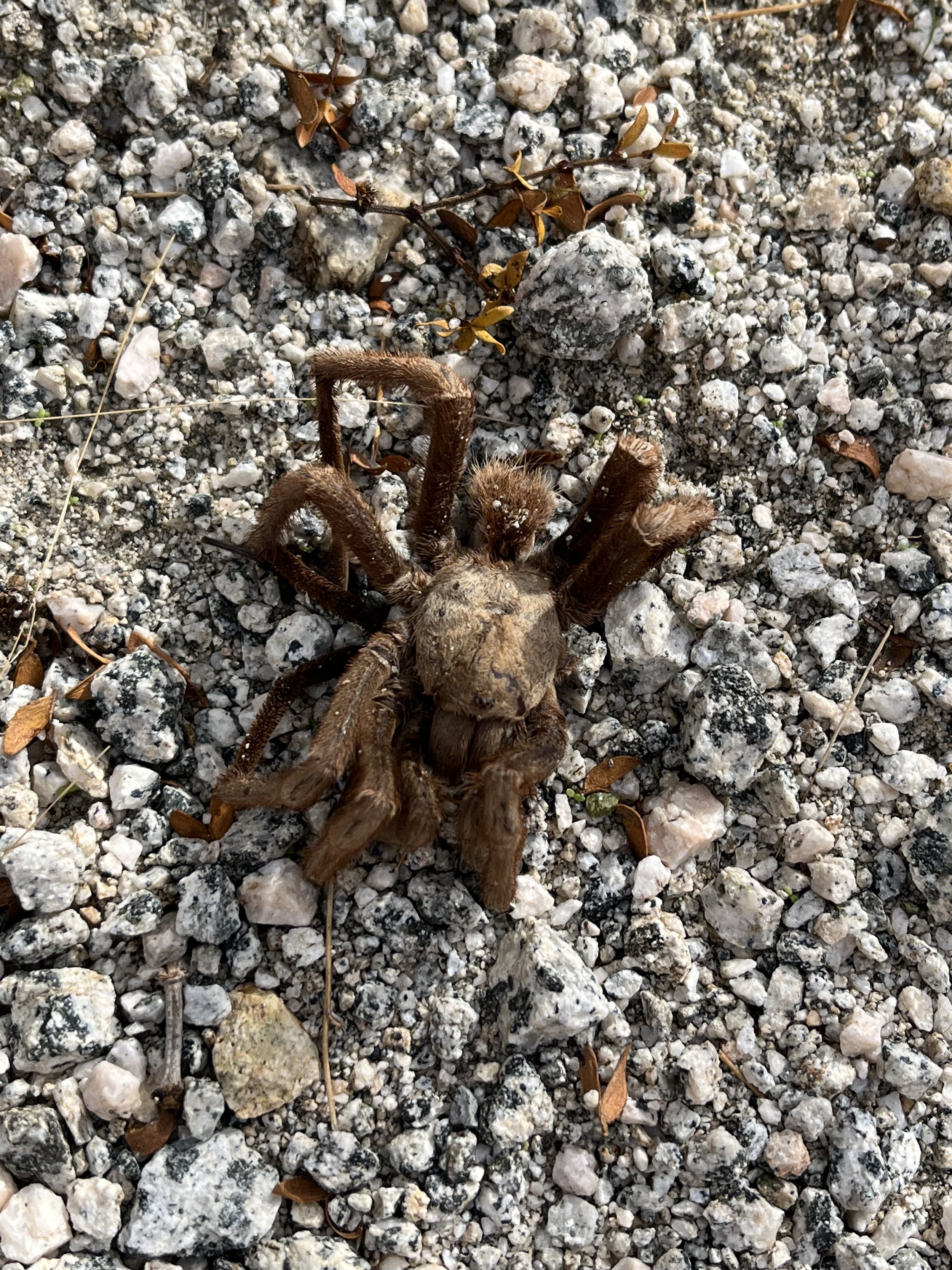
I saw my first tarantula on a hiking trail. (I saw them often while biking when living in Central California but never on a hike!
I met and gave a hitch to PCT 2023 Hiker Bigfoot who was wrapping up his 750 mile section he hiked, he told me I was the first person he had seen in four days! It was mid-December so thru hikers were done and it’s not the most popular day hiking spot. To offer him some trail magic and get to chat made me feel right back at home on the trails after the 13 weeks on the AT.
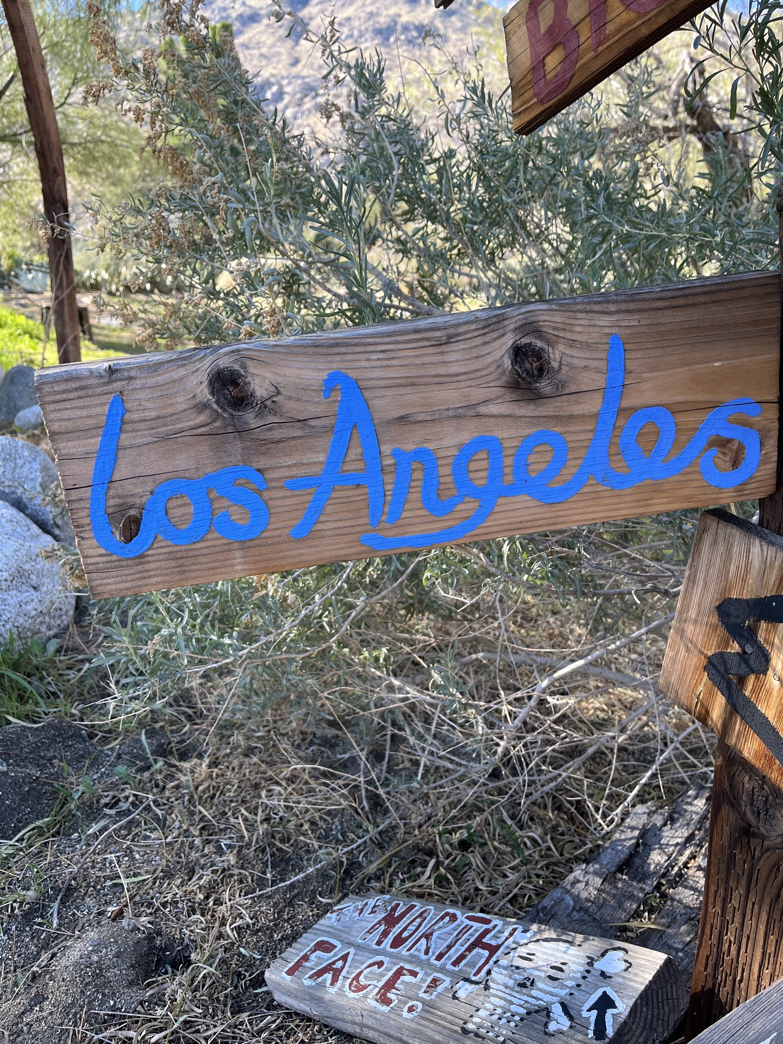
There’s a home in Snow Creek Canyon that offers a bench and some rad looking “mileage” signs that is worth a few photos!
Cabazon California features two roadside dinosaurs named Dinny and Mr. Rex. I had driven by them on my way to LA many a time but now that I know Cabazon is a resupply town it makes the list of funky and fun additional attractions on your hike!
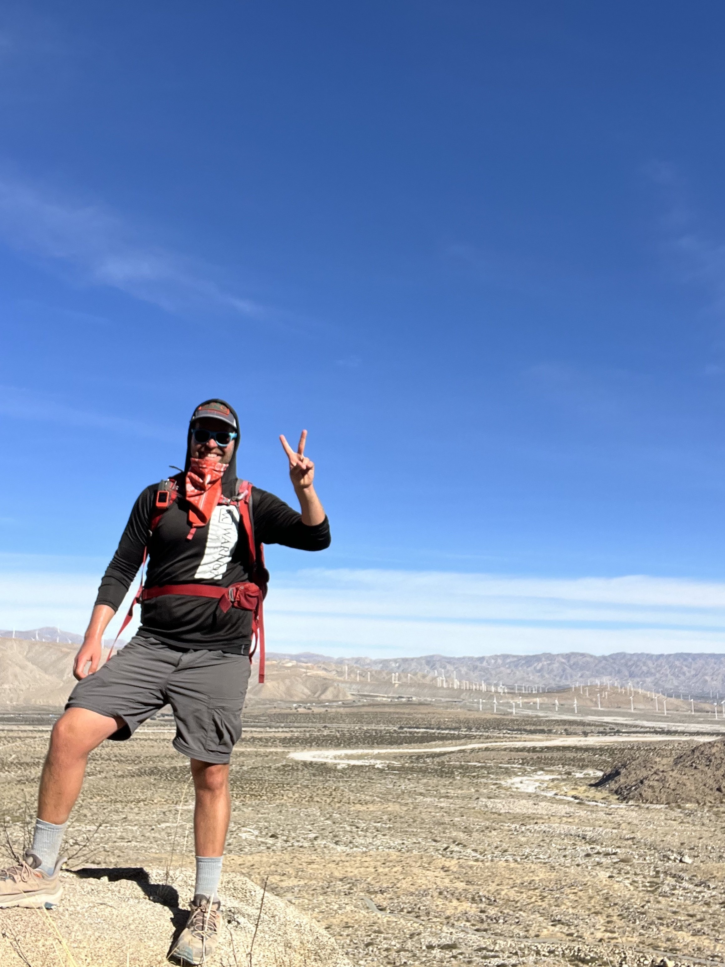
Seeing the Wind Farms up close was unique and interesting.
I would like to move to Idyllwild and work for Mayor Max, anyone who has a dog in charge is good by me!
WHAT GEAR DO I USE AND LIKE THE MOST ON MY PCT SECTION HIKES?
Hoka One Kaha’s are my trusted shoes.
I use my REI 40 Liter Backpack.
Darn Tough Vermont and Merino Wool Socks from REI and SmartWool are my go to’s.
Osprey Water Bladder and Lifestraw Collapsible Filter for hydration.
I wear New Balance running shorts mainly and much prefer that to more typical hiking shorts.
The PCTA and PCT Water Reports in addition to the Half Mile Maps and Trail Notes are outstanding resources (and could save your life…!)
I carry a Garmin GPS and if I were to thru hiker use the Farout (used to be Guthook) App as well.

To me there’s something magical about these big scenic trails. (Appalachian Trail, Pacific Crest Trail, Continental Divide Trail, Arizona Trail, etc.)
Street parking for the trail crossings in neighborhoods where people have never even heard of the trail, magical oasis’s by trail angels, and a game of puzzles as you find mile markers and trail signs as you venture on and hope to not have to turn back.
Plus the idea that you can go NOBO and go SOBO depending on how you feel is exciting and thrilling to me. It’s more than just a day hike. It’s an adventure that you can weave and craft many different ways.
This is a section of the PCT that many would assume skip and head to Joshua Tree, Palm Springs, or Big Bear for more “scenic” views but that’s what is so special about the PCT. The trail climbs and it descends and you go up again. Desert and mountains and forests and trail magic and water caches (hopefully that are reliable) and sore feet and no mountain lions (fingers crossed.)
It goes from Canada to Mexico or vice versa but it’s always just here waiting for us to do a few miles or a few days if you can’t do all 2,650 miles at once. Because of the equestrian approved grades this is a great section of trail that will push you (especially SOBO towards Mexico and up near San Jacinto Peak) but never so steep that one can’t handle it with some grit and training.
The parking lots lie just off of one of the busiest interstates in the most populated state in the country. And within minutes of walking you will find yourself all alone walking the PCT. That’s what I love about this section and the National Scenic Trails in general!

This is a great section of the SoCal PCT that is close to anyone living in the Coachella Valley and not far for San Diego and LA folks. It features high elevation mountains, the desert floor, an interstate, and massive dinosaurs if you resupply your stash of peanut butter.
This 36.3 mile stretch was done in three half day hikes with some out and back miles. Have fun, prepare, and welcome to the “Inland Desert Empire” of Southern California!
Thanks for reading and happy trails to you! Whether you are planning a thru, section, or day hike…or are a trail town local, trail angel, or just someone wanting to learn more about the Pacific Crest Trail…I hope the PCT gives you what you need! Don’t forget to Leave No Trace and pack your 10 Essentials!
Comment below with questions or your experience on hiking the PCT in the SoCal or specifically the Snow Creek/Cabazon sections.
Because Adventure Feeds the Soul,
Mike R