Pacific Crest Trail Section Hike: Onyx Summit to Big Bear Lake California
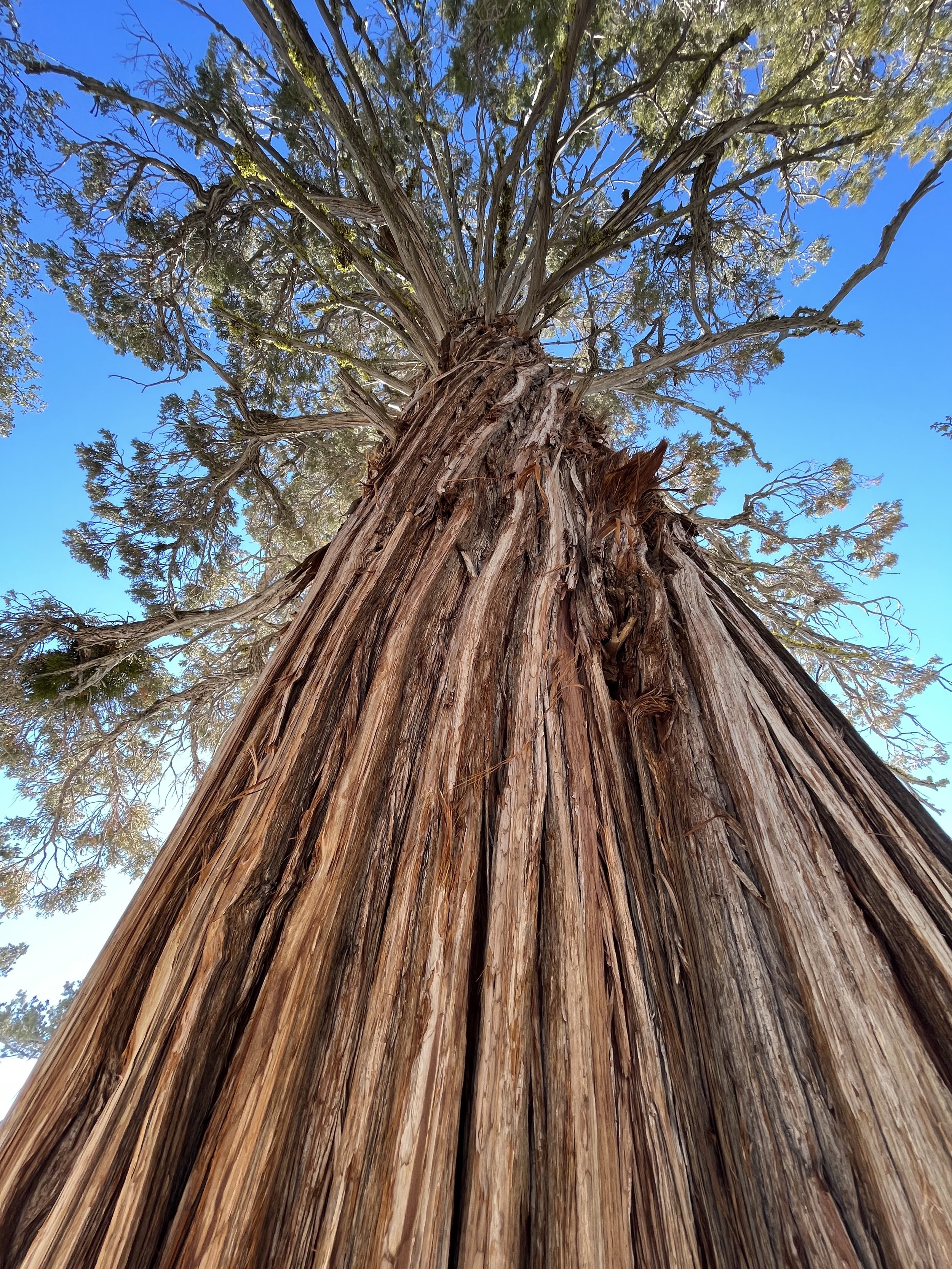
San Gorgonio is the highest point in Southern California at over 11,500 feet high. The Pacific Crest Trail (PCT) runs through the San Gorgonio Wilderness before heading up to Onyx Summit and towards the popular Ski Town of Big Bear Lake and Big Bear California. In this article I share a 38.6 mile section hike of the trail that runs through this region of California. I am slowly section hiking the SoCal section (and then hopefully the rest) of the Pacific Crest Trail (PCT for short) that is 2,650 miles in total. In this series we are covering each section I hike and hopefully providing tips and insights into how you can spend an afternoon to a few days at a time on this trail that stretches from Mexico to Canada! Or for several months as a thru-hiker!

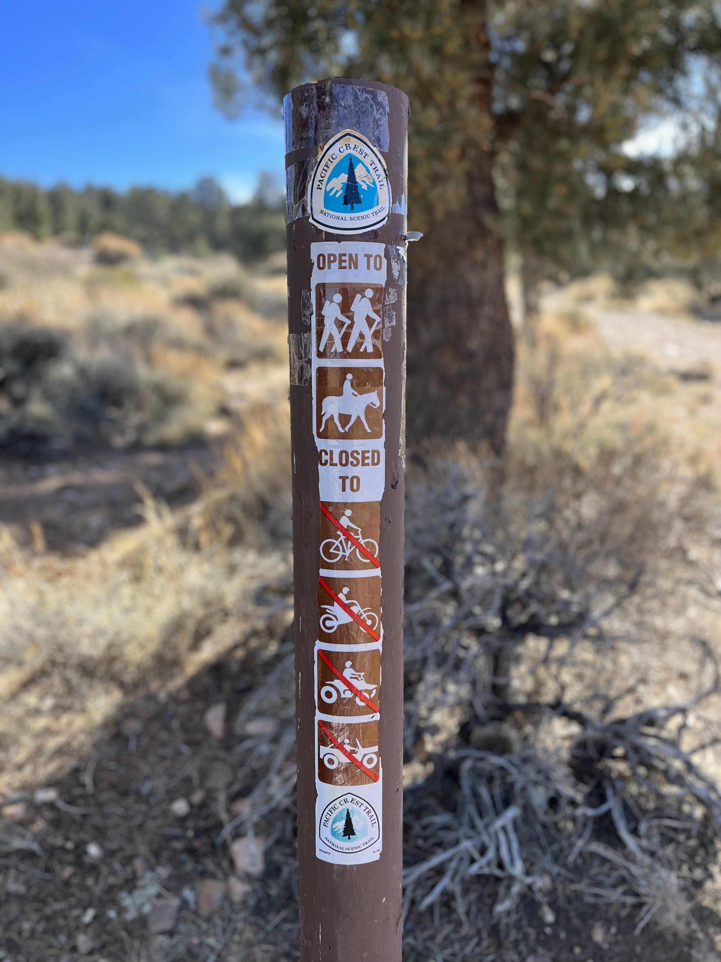
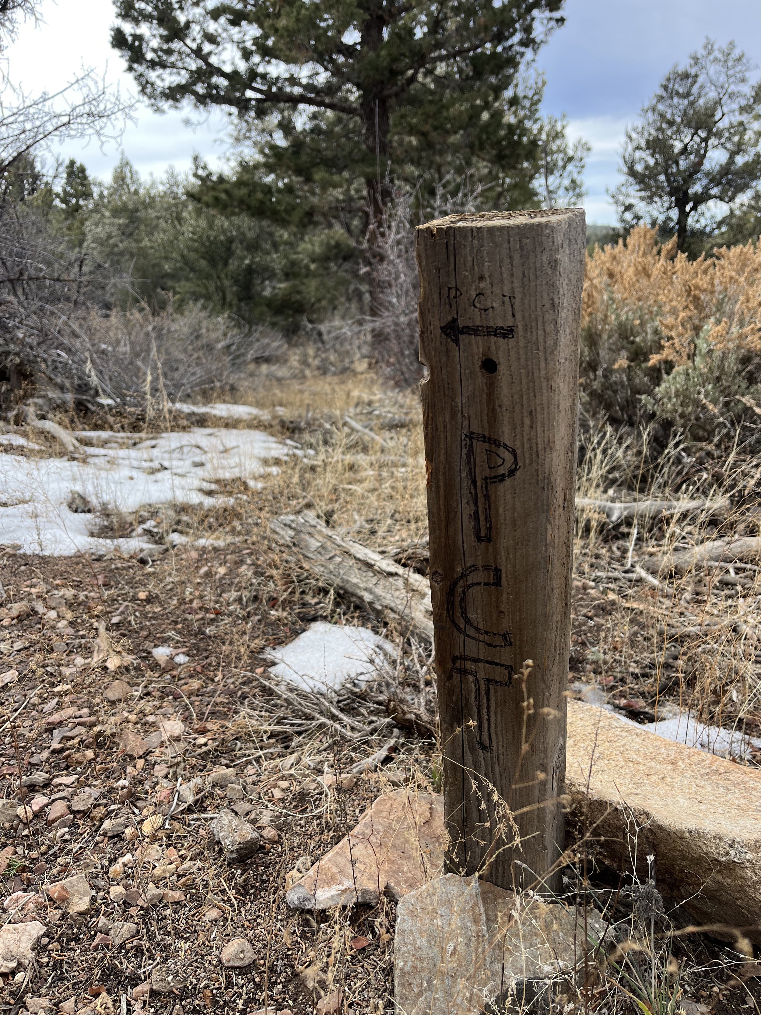
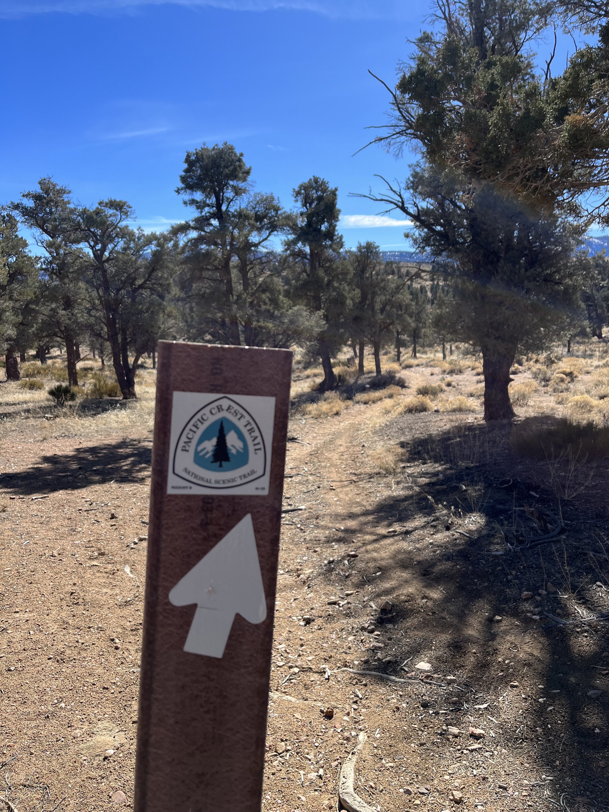
The PCT Trail Marker in February. Snowed in on a day hike from the Cougar Crest Trail.
IF HEADING NOBO (NORTHBOUND) ON THE PACIFIC CREST TRAIL THE EDGE OF THE SAN GORGONIO WILDERNESS IS MILE MARKER 240.0 as we begin at the junction with the fish creek trail towards the peak. THIS 38.6 MILE STRETCH IS WHAT I COVERED IN Three DAYS AS OUT AND BACK DAY HIKES AND SOME OVERLAP MILES. THERE IS AN OPTION TO TAKE THE FISH CREEK TRAIL TO THE GORGONIO SUMMIT. THERE IS PARKING, CAMPSITES, AND WATER AT the Fish creek trail, onyx summit, highway 18, and a junction with the cougar crest trail. THE TOWNS OF DESERT HOT SPRINGS, MORONGO VALLEY, YUCCA VALLEY, PALM SPRINGS, AND JOSHUA TREE ARE ALL LESS THAN AN HOUR AWAY. the towns of big bear lake and big bear city can be accessed from the highway 18 gap, the cougar crest trail junction to highway 38, or where our section hike ends at holcomb valley road 2n09. this road also has access to highway 38 in big bear california.

Big Bear California and Onyx Summit Pacific Crest Trail Section Hike Need to Know’s:
San Gorgonio is covered in snow in most of the year and to begin your section at the Fish Creek Trailhead we would recommend a 4WD Clearance Vehicle. If you started 12 more miles NOBO at the Onyx Summit there is a dirt road as well that hikers park at during the summer months to access the PCT. I did some out and back hiking to cover these miles. Some say you need 4WD for Onxy Summit, others don’t. Depends on how you like to treat your vehicle I guess :).
The San Gorgonio summit add on is a SERIOUS hike and should be taken as such. Preparation and knowledge of the backcountry (along with a permit) is required. For more information on the permit, visit: https://sgwa.org/wilderness-permits/.
This section begins at the boundary of Sand to Snow National Monument. The Cahuilla Indians call the mountain Kwiria-Kaich, which means "bald" or "smooth," and consider it among the sacred peaks of southern California. From here you can get off trail at Onyx Summit, Highway 18 near Big Bear California, a road crossing a few miles past Highway 18 near Baldwin Lake, connect with the Cougar Crest Trail for two miles to Highway 38, or finish at Mile Marker 278.6 and head towards Highway 38.
Camping is available at Coon Creek and Arrastre Trail Camps along the PCT. There is also a wide variety of National Forest, Hostels, Lodges, Hotels, and Resorts in Big Bear Lake California.
Big Bear Lake and Big Bear City are two DIFFERENT towns. Big Bear Lake has way more amenities if you are looking for a resupply or an expensive night out haha!
Predators in Action is a now retired caged animal house of a man who won an Academy Award apparently for him and his tiger’s role in the movie Gladiator. Don’t be alarmed to see Tigers and Bears in cages as you pass around mile marker 250. I am not sure of the current status of how many cages and/or the humane treatment of the animals. This is more of an FYI for you!
You will need a National Parks Pass or a California Adventure Pass to park at Highway 18 or the Cougar Crest Trail. Pick one up at the Big Bear Discovery Center if you don’t already have one.
What else happened that was memorable during this section hike?
I caught an unseasonably minimal snowpack year while in Joshua Tree California. I didn’t imagine I would be able to hike this section but the snow came later than normal. This section would be best completed in the summer/early fall. Whereas I did it later in the fall.
Big Bear City and Big Bear Lake nearby created some fun encounters with other hikers. People were sometimes SHOCKED when they found out they were hiking on a trail that extended from Mexico to Canada, or vice versa!
For the jumps in elevation that you get the hiking isn’t that tough in my eyes. Since the PCT has small grades because it’s also an equestrian trail it doesn’t push you as hard as you might imagine a long stretch of trail between 6,000 and 8,500 feet in elevation would.
I ran into my first PCT horse dog hiking combination with a woman who was out for a ride from her horse camp!
I had one day completely to myself. I didn’t encounter another animal or human. I had another day that I saw more hikers than all of the other days combined on the PCT that I did hiking over a 150 mile total stretch of it!
The views of Big Bear Lake were as promoted. It’s stunningly beautiful and on my final day I took the Cougar Crest Trail down to finish my hike. I enjoyed a walk along the lake and kids on sleds as I got back to Highway 38. There is a reason it’s “Southern California’s #1 Four Season Destination.”
WHAT GEAR DO I USE AND LIKE THE MOST ON MY PCT SECTION HIKES?
Hoka One Kaha’s and Hoka Two GTX’s are my trusted shoes.
I use my REI 40 Liter Backpack.
Darn Tough Vermont and Merino Wool Socks from REI and SmartWool are my go to’s.
Osprey Water Bladder and Lifestraw Collapsible Filter for hydration.
I wear New Balance running shorts mainly and much prefer that to more typical hiking shorts.
The PCTA and PCT Water Reports in addition to the Half Mile Maps and Trail Notes are outstanding resources (and could save your life…!)
I carry a Garmin GPS and if I were to thru hiker use the Farout (used to be Guthook) App as well.

The combination of the Onyx Summit and Big Bear California makes this an epic summer and early fall PCT Section Hike option! I loved coming up here from the desert to higher elevations. The trees and the smell reminded me of being in Colorado, Washington, or Flagstaff Arizona. There’s sweeping views of San Gorgonio or Big Bear Lake or the San Bernardino Mountains at almost every turn!
This was a surprise section hike of the PCT for me as I mentioned and sometimes that’s exactly what you need. A trail you didn’t originally plan on doing. A place you had never visited but heard plenty about. (Big Bear gets a TON of hype from SoCal residents.) It shifts perspective, challenges you on the trail, and the parking gaps are some of the easier ones I encountered on so far while hiking sections of the Pacific Crest Trail.
I only used my micro spikes once but I would definitely recommend having them just in case, depending on your time of year. In 2023 the number one reason PCT Thru-Hikers didn’t finish was snow and injury. (According to the PCTA Survey.) This is the final push before you head back towards Los Angeles and the famous sections around Cajon Pass, the Mojave Dam, and the Aquaduct. Not always the most memorable sections according to PCT Thru-Hikers. But I have charm and joy in all of the different sections i have done so far on the PCT!
This 38.6 mile stretch was done in three quickly moving all day long hikes with some out and back miles on top of it. You can also tack on (always check the weather first) a summit of San Gorgonio via the Fish Creek Trail to add another day to this section. You can also continue past Big Bear towards the Mojave Dam Reservoir or hit Big Bear Lake for some R&R.
Have fun, prepare, and welcome to another stretch of big peaks in the “desert” section of the PCT.
Thanks for reading and happy trails to you! Whether you are planning a thru, section, or day hike…or are a trail town local, trail angel, or just someone wanting to learn more about the Pacific Crest Trail…I hope the PCT gives you what you need! Don’t forget to Leave No Trace and pack your 10 Essentials!
Comment below with questions or your experience on hiking the PCT in the SoCal or specifically the Onyx Summit and Big Bear Section.
Because Adventure Feeds the Soul,
Mike R